
[This article was produced by B.C.’s Hakai Institute, which conducts scientific research from ice fields to oceans in British Columbia and beyond. Read the full version at the Hakai Institute: hakai.org/the-big-slide.]
No one saw the massive landslide in a remote British Columbia valley in late 2020, but it was detected by seismic instruments as far away as Australia.
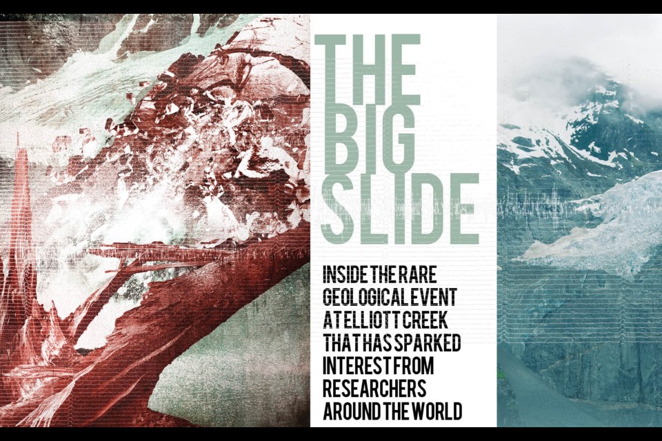
In a few seconds, 50 million tonnes of rock—roughly equal in weight to 150 Empire State Buildings—dropped from a sheer mountainside.
Then it hit Elliot Lake.
Goran Ekstrom follows earthquakes the way some people read the daily news.
An earth sciences professor at the Lamont-Doherty Earth Observatory at Columbia University in New York, he learns about seismic activity in the planet’s most remote areas—earthquakes in the Baikal Rift Zone in northern Mongolia, a landslide in Alaska’s Taan Fiord—before just about anyone else.
Ekström checks two lists regularly: one a global roundup of earthquakes, the other a shorter tally of probable landslides and other “peculiar events.”
Both lists are generated at Columbia from data amassed by the Global Seismographic Network (GSN). The GSN monitors Earth’s shakes and shudders at more than 150 stations around the world, kicking out measurements known as seismograms (Ekström and his colleagues refer to them as “wiggles”). These are the digital versions of those scrolling ink-on-paper seismic readings familiar from earthquake disaster films, and Ekström scours them for anomalies.
“I am fascinated by finding things that nobody else has found before,” says Ekström. “When I find something on these lists that looks a bit strange, I look at it more carefully.”
What separates the signature of a fault-based earthquake from less common seismic events—a colossal landslide, the calving of a Greenland glacier, the collapse of a volcanic caldera—is a fairly technical distinction that can involve phrases like “azimuthal anisotropy” and “laterally heterogeneous phase velocity structure.”
But at its core, the difference is between the jolting waves of a typical fault-slip earthquake—known as body waves, which travel through the Earth—and the slower-moving surface waves created by the impact of a falling mass.
In late November 2020, one of the wiggles on the list of surface waves caught Ekström’s attention. Located in the Pacific Range of British Columbia’s Coast Mountains, it was of significant size: measurements ultimately judged it comparable to a magnitude 5.0 earthquake.
This doesn’t mean that the ground in the vicinity shook as it would during a magnitude 5.0 earthquake but that the signal was of the same strength. As Ekström says, comparing the energy of an earthquake with that of a landslide is “complicated.”
However you measure it, it was a very big boom. The event’s signature showed up at sensor stations around the world, including in Germany, Japan and Australia.
Searching for a landslide
Determining the exact source of the signal, however, remained foggy.
“I’m a busy guy, and looking for landslides is not the only thing I do,” says Ekström. “But this British Columbia detection indicated a landslide of unusual size. I thought it should show up in satellite imagery, and so for verification I sent an email off to one of my buddies.”
An earthquake may or may not leave a visible trace of its occurrence, but big landslides usually do—when the resulting scar and rubble aren’t covered in snow. On occasions when he’s hopeful of seeing visual evidence rather than only wiggles, Ekström looks for outside help.
Enter Marten Geertsema, a research geomorphologist with the Province of British Columbia. Geertsema specializes in landslide events in British Columbia and Alaska. After receiving Ekström’s email about the big wiggle, Geertsema began poring over satellite imagery to see if he could spot the source.
This kind of detective work is an inexact science: with no eyewitnesses to report an event, researchers can usually only roughly estimate where the seismic signal originated. These estimates can be fairly accurate, within five or 10 kilometres, or they can be off by 50 kilometres or more.
Geertsema used satellite imagery generated by the private Earth-imaging company Planet Labs, which uses an array of over 200 satellites to photograph landscapes all over the globe on an almost daily basis.
Ekström’s data showed the source as being located near Tatlayoko Lake in British Columbia’s Coast Mountains, and Geertsema spent many hours looking around that area within a radius of 50 kilometres.
Despite the up-to-date geospatial data, he couldn’t find evidence of Ekström’s big wiggle.
It wasn’t until word spread about images posted on social media by a B.C.-based helicopter pilot that ground zero was revealed.
In a post on the Instagram account of 49 North Helicopters—a charter company and flight training academy on Vancouver Island—pilot Bastian Fleury noted that he and others had heard about “an unusual amount of wood” in British Columbia’s Bute Inlet (Yitcht in the Homalco language), located about 200 kilometres northwest of Vancouver.
They went to check it out, and when the chopper crew veered up the mouth of the Southgate River (Míimá7ya) at the head of Bute Inlet, they found widespread devastation for several kilometres up the Elliot Creek valley, with thousands of uprooted trees and an enormous deposition of sand and gravel where the creek hit the Southgate.
Fleury wrote in his post—correctly, as it turned out—that it “might be one of the biggest landslides the West Coast has had in the last few years.”
Geertsema heard about the Elliot Creek slide, but it took some days to connect the dots to Ekström’s request. Because the Elliot Creek event was about 60 kilometres from the estimated origin of the mysterious wiggle, Geertsema assumed it was unrelated.
“I thought it was a second event,” says Geertsema. “But that was the one Göran had detected.”
Thanks to Fleury’s images, researchers were aware immediately that the landslide was only part of the story: what they were seeing was evidence of a chain reaction.
Geoscientists call it a hazard cascade. At Elliot Creek, the cascade had three main parts.
The fall
At 6:53 a.m. on Nov. 28, 2020, the chain reaction began when 50 million tonnes of rock released from the slope adjacent to West Grenville Glacier, which is the feeder glacier for Elliot Lake.
The landslide was equal to dumping 150 Empire State Buildings—or, as Ekström pointed out, all of Canada’s 25 million cars—off a cliff.
Broken rock tumbled from as high as 600 metres above the glacier, then dropped another 300 metres of vertical elevation as the mass moved onward to the lake.
“Once this thing goes it’s quite sudden and quite catastrophic,” says Brian Menounos, a research professor in glaciology and geomorphology at the University of Northern British Columbia.
“We’re talking about dislodging approximately 18 million cubic metres of material and releasing it down a 50- or 60-degree slope. It’s going like a freight train.”
In a few seconds, says Menounos, the landslide hits the lowermost part of the glacier, called the toe, likely liquefying some of its ice through friction.
“The material hits the glacier and then the opposing valley side, but it doesn’t stop there. It actually is now deflected into the lake.”
The tsunami
Part 2 of the hazard cascade is sudden, short, and dramatic.
When the landslide slammed into two-kilometre-long Elliot Lake, it was traveling around 170 kilometres per hour. The impact displaced a huge amount of water and kicked up a 100-metre tsunami wave.
An estimated 15 million cubic metres of water was ejected from the lake like a giant had done a belly flop into a bathtub.
That’s a lot of water: picture a water-filled aquarium with a base the size of four soccer fields and as tall as the Eiffel Tower—then dump it downhill.
“By that point,” says Menounos, “about 30 seconds in, we estimate about 40 per cent of the material was deposited above the lake and the rest hits the lake—hits it so violently, you get a whole lot of water leaving the lake in one go.”
The outburst flood
The enormous amount of water ejected from Elliot Lake created what geomorphologists call a GLOF—a glacial outburst flood. Outburst floods are a function of the unstable conditions that surround alpine glacial lakes and the basics of gravity: given the chance, water at high elevations will head to sea level as fast as terrain will allow.
Mixed with sand, rock, and other material, the waters of Elliot Lake roared down the creek’s drainage toward Bute Inlet, tearing out trees and soil on either side of the gorge and forming an immense debris flow of logs, branches, and sediment.
“In glacial lake outbursts, you mix water and broken rock flowing at high velocity and you’ve got a big problem,” says John Clague, a scientist emeritus with the Geological Survey of Canada. “That’s a dangerous combination.”
The outburst at Elliot Creek surged down the valley at about 135 kilometres per hour, reaching the Southgate River 10 kilometres away in about six minutes.
While glacial outburst floods—also known by the equally catchy Icelandic term jökulhlaups—may be fairly low on the list for anxiety-inducing climate change–related disasters, they can be deadly.
Globally, there have been more than 1,000 of them since 1900, resulting in thousands of deaths and much destruction to agricultural areas and infrastructure.
In Peru in 1941, an outburst flood tore down from Lake Palcacocha, high in the mountains about 20 kilometres outside the city of Huaraz. The debris flow destroyed a third of its buildings and homes and killed more than 1,800 people.
An even deadlier event struck in 2013 in northern India near the Tibetan border, when a GLOF and debris flow ravaged the town of Kedarnath and killed at least 5,000 people.
Disappearing ice and unstable slopes
“We were fortunate to witness a grand sight just after sunrise.
On the opposite side of the river, nearly half a mile from us we heard a sharp crash and then a loud rumbling sound high up on a mountain directly in view.
The entire side of the mountain for fully a mile in length was in motion.
A huge avalanche came thundering down with a frightful noise, pine trees going down before it like a swath of mown grass; it lasted several minutes, the ground sensibly shaking from the violence of the shock, and enormous masses of rock came crashing down into the valley below.
Immediately it was over dense clouds of steamy vapour arose, caused by the heat from the friction of the immense masses of rock grinding and crushing against each other in their descent …”
- Nov. 27, 1861 journal entry by Robert Homfray, recording a Hudson’s Bay Company expedition from Victoria to Bute Inlet and up the Homathko River (Xwémalhkwu).
Avalanches and landslides are a feature of life in steep alpine areas like the Pacific Range. Homfray’s journal entry from Nov. 27, 1861—159 years almost to the day before the Elliot Creek slide—describes a landslide in the Bute Inlet area. It may have been large enough to have registered on seismic sensors, if they had existed at the time.
Understanding the causes of a landslide is notoriously difficult. How steep and how fractured a rock slope is are two critical factors, as is the direction the fractures run, known as the jointing pattern. Were the cracks and fissures in the rock aligned with the slope, or did they run at a more perpendicular angle?
“Anytime you get a landslide or any sort of instability, there tends to be a setup condition,” says Menounos, noting that fractures which run parallel with the direction of the slope tend to be more dangerous and unstable.
“It’s all about the stress-strain relation in the rock. And then you have something, some straw that breaks the camel’s back, the event or events that trigger the failure.”
While researchers don’t believe a seismic event caused the Elliot Creek landslide, a less dramatic factor might have contributed: water. Up to 10 centimetres of rain fell in the week prior to the slide, and snowmelt may have matched or exceeded that.
“While not as wet as 2021, the previous year was a particularly wet one for many parts of B.C.,” says Menounos. “In fact, if you go north to Prince George, there was a lot of ground movement happening in early 2021, in large part due to wet conditions over the preceding year. How much that played into the failure is hard to say.”
Though the exact trigger remains unknown, Menounos, Geertsema, and other researchers are certain that climate change played a major role in destabilizing the slope.
Glaciers have been eroding the valleys of the Coast Mountains in Western Canada for more than two-and-a-half million years, trenching them and creating steep valleys.
Because of climate change, as Menounos noted in a 2019 paper, the southern part of the range is now being transformed by some of the highest rates of glacial loss on the planet.
Melting alpine permafrost is a factor frequently implicated in landslides, but it wasn’t part of the picture at Elliot Creek. Rather, geohazard experts have singled out deglaciation.
“In the case of Elliot, we know that we’re dealing with a rapidly retreating glacier, the West Grenville Glacier, in a deep and steep valley,” says Menounos.
During the Little Ice Age that lasted roughly from the 14th century to the mid-19th century, glaciers expanded in mountainous regions around the globe, from Eurasia to the Americas to New Zealand.
The West Grenville Glacier would have reached its Little Ice Age maximum around the beginning of the 18th century—extending four kilometres farther down the Elliot Creek valley from its current location, and buttressing the valley walls up to heights of over 300 metres.
“When you have a glacier traveling down valley, it causes a lot of erosion and imparts stress fractures on the valley slopes,” says Geertsema.
“As the glacier retreats, often these stress fractures, which tend to be parallel to the slopes, tend to open and widen and that can set off a cascade of events.”
As glaciers retreat, the exposed faces they leave behind present potential catastrophic geohazards, a situation known as debuttressing.
“While the ice is there it’s part of what is supporting these very steep faces,” says Menounos. “When it pulls back, when the glacier has retreated, you have this release of this supporting structure of the ice. That creates instability.”
Hakai Institute researchers had been mapping the Elliot Creek area with aerial lidar prior to the slide, and from this and other observations they estimate that the rock mass was already slowly shifting at about 40 centimetres per year.
“It was very fortuitous to have the pre-event lidar and then the post-event lidar, so we could see that,” says Geertsema.
“A lot of times you don’t have that data, which, with debuttressing situations, will often show slopes sagging like that. They can slowly move for a long time, and never transform into a violent, catastrophic release. But with Elliot, the slow movement was just the lead-up.”
A longer version of this article was originally published by the Hakai Institute on March 29, and is republished here with permission. For the full multimedia feature—which includes video, interactive maps, and more—visit hakai.org/the-big-slide.


