Port Moody will look into a software program that would allow it to create 3-D renderings of the city as it currently exists, as well as how future developments could have an impact.
But how much such capability will cost depends on how sophisticated the city wants to get, its proponent Slava Oganesian explains.
The CEO of Montreal-based Lunas Inc. told city council’s committee-of-the-whole Tuesday (Nov. 16) his company’s L’Touch software would allow the city to visualize its growth years into the future so it could more accurately assess potential impacts on issues like traffic.
It can also drill down to present detailed data at the neighbourhood level and even capture scans of specific buildings like important heritage or cultural structures to create a digital 3-D archive that can be referenced should anything happen to them.
Oganesian said while the software is currently used mostly by real estate developers and architects, his company is in the process of pitching it to municipal and regional governments because "we see a huge gap between developers, city halls and residents when they are communicating about new development."
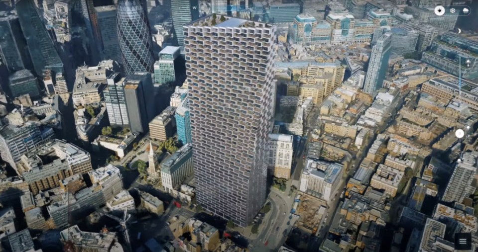
The 3-D renderings of an urban area are assembled from thousands of detailed scans taken from an aircraft.
They can then be viewed from any angle on a large touchscreen monitor and even account for the lighting at different times of the day. Digital models of future development can also be inserted into the renderings.
Oganesian said the software will even project the potential impacts from rising waters due to climate change.
Several councillors liked what they saw.
"What an incredible concept," Coun. Diana Dilworth said.
"This is the future," added Coun. Hunter Madsen.
But as excited as they were, they were also leery of the expense.
"Obviously, the cost question is difficult to predict," said Coun. Zoe Royer.
Oganesian, who told council he’s also pitching the program to Metro Vancouver, said the cost of the software and other related technology can vary depending on which options are included.
But as a measuring stick, he indicated the cost for taking the aerial scans of Metro Vancouver would be about $250,000, then integrating those images into the software would double that.
From there, the price escalates for specific modelling options like scans of individual buildings.
Still, city councillors were intrigued enough to send the idea on to staff for further investigation.


