
The sun rises unobstructed over Whistler on an early June morning; blue skies, fresh mountain air, and not a hint of smoke from wildfires near or far.
It's 7 a.m., and FireSmart coordinator Scott Rogers has assembled his four-person crew at the municipal public works yard for a full day of brush chipping.
Rogers presents a list with 11 addresses—homes with piles of brush waiting to be chewed up and trucked away.
Using FireSmart principles, homeowners have protected their properties from the threat of wildfire by removing nearby trees and branches.
Community response to the program has been overwhelming, Rogers says, and that's an encouraging sign. FireSmarting your property is hugely effective in mitigating the rise and spread of wildfires.
"Most properties in Whistler are vulnerable because they have a woodshake roof, and/or they've got coniferous vegetation that's in close proximity," Rogers says.
What creates the most loss in a wildfire event is the spread of "firebrands"—burning embers carried by wind and deposited in different areas.
"Whatever they deposit on, if they can involve them, they create new fires, which is why suppression is so challenging," Rogers says.
"We know that fire brand commonly travels 500 metres in front of the fire front, so we ask ourselves, where in Whistler is not half a kilometre from significant forest? The answer is nowhere."
Surveying the valley around us, he's right: a thick blanket of coniferous trees spreads out in every direction. Beautiful, yes, but nerve-wracking all the same.
Homeowners looking to protect their property have to ask themselves: if firebrand landed, what would happen?
"What these chipper-service days are doing are removing the fine fuels and the ladder fuels ... the low hanging limbs that would allow a surface fire to move up into the canopy," Rogers says.
"So when homeowners are pruning their conifers up and they're pulling the brush out, they're making a really significant step toward their resilience to firebrand."
Rogers and his crew head north to their first stop of the day in Emerald, and as the Resort Municipality of Whistler (RMOW) truck pulls up, FireSmart logo on the side and trailer and chipper in tow, it hasn't been parked for more than a few minutes before a homeowner comes outside to ask Rogers about the program.
Friendly and knowledgable, Rogers is well-suited to the educational side of his role—a major factor in making Whistler FireSmart.
A paid-on-call firefighter for the last decade, Rogers also has landscaping, construction, project management and community organization in his background—all useful skills to the job he's now tasked with.
"What encourages me is seeing how many people are getting active ... when I started this role I felt one of my biggest challenges was going to be convincing people to take their head out of the sand," Rogers says.
"That's not the case. People are tuned in, they just want a little bit of guidance, and they want some help. And so we're well on our way for sure."
Rogers' discussion with the homeowner finished, the chipper is fired up and the crew makes short work of a sizable pile of brush before tidying up and preparing to move on.
It's another beautiful summer morning in Whistler, and all is right with the world, for now.
A stark contrast
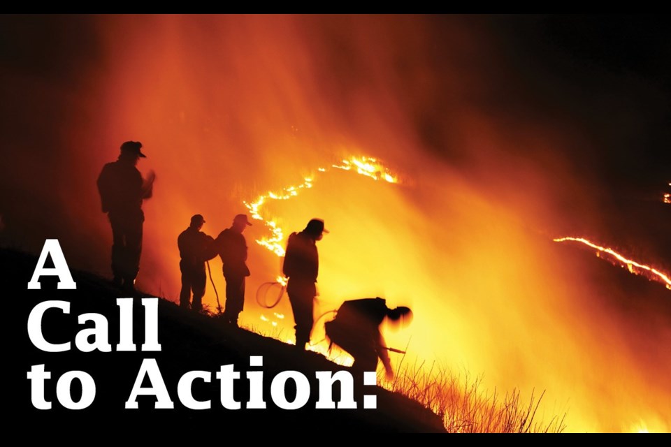
A three-minute dashcam video of the 2016 evacuation of Fort McMurray highlights the importance of FireSmart better than anything else could.
"Keep an eye on screen left—some big fires coming," interface fire protection specialist Don Mortimer tells a crowd of close to 200 at the Wildfire and Climate Change Conference (WCCC) in Nelson on June 26, as the video plays in the background.
The rear-facing dashcam shows a patiently evacuating community with a roaring wildfire to the left and residential homes to the right.
"That's a lot of heat coming off that fire. It's not fatal, it's not disabling to the vehicles, nobody died, but it is a lot of heat, and notice that the structures did not ignite from that radiant heat, or any convective heat," Mortimer says.
Eventually, though, a planting in one of the front yards catches fire.
"A small pine that was an innocent lawn planting home from the nursery, and now look at it go. Maybe a little too close to the structure," Mortimer says, as the spot fire transforms into a full-blown house-destroyer in a matter of seconds.
"Pretty impressive: from a small pine, now the deck, now the house, it's into the living room, and there we have it."
As alarming as it is, the footage is incredibly valuable in teaching about prevention, mitigation and preparedness.
"I use it in discussing structure ignitions, in terms of how did these houses ignite from that fire, (and) I use it in validating FireSmarting mitigations as we draw out our priority zones in front of the structures," Mortimer says.
"It's highly motivational. People are affected by what they see, and recognize that could be their property."
Visuals like those—Fort McMurray in 2016, Slave Lake in 2011, or from across the province of British Columbia last year—were a partial driving force behind the WCCC, a two-day conference compiling a wide range of perspectives.
Delegates included representatives from BC Wildfire, Parks Canada, universities, ski resorts and industry, as well as from local governments, First Nations, fire departments, community forests and more.
Getting all those voices in the same room was key to the conference.
"It's clearly this sort of situation where we need to be doing more, and we need to be building on all of the great things we're already doing, but we also need to have everybody (working together). We need to have all hands on deck, essentially," says forest consultant John Cathro, one of the facilitators of the WCCC.
"I think what was really unique about the way this conference was structured was this was the first time that land managers and fire chiefs and community people and government decision makers were all in the same room talking about the same thing at the same time."
For many, it was the first chance to look at wildfire from all angles, and hear the concerns of everyone involved.
"One of the strongest calls to action was a greater need for collaboration, and I don't think that would have happened if there wasn't that diversity of perspectives in the room," Cathro says.
"I don't think it's as simple as saying we could reduce our risk if we had more money. I think the solutions are more about our ability to work together and to prioritize this issue over all of the other really, really important things that we all have to do.
"If we do that, I think the money and the other resources will fall into place."
Whistler's total budget in 2018 for wildfire protection is $1,462,000—$618,000 from municipal reserves and $844,000 from provincial grants.
That's down slightly from the 2017 budget of $1,741,800 ($804,200 from the RMOW and $937,600 from provincial grants).
The Cheakamus Community Forest also got $388,850 in provincial grants for a fuel-thinning project along Callaghan Service Road.
"Funding went down somewhat in 2018 due to more accurate budget forecasting for projects," an RMOW spokesperson said in an email.
"The RMOW's targets of 30 hectares of interface fuel thinning (behind neighbourhoods) and 40 hectares of fuel break thinning (along forest service roads) (are) being met."
This year, the RMOW is doing fuel-thinning work near Big Timber/Kadenwood, Alpine Meadows and the Whistler Cemetery, as well as along Callaghan Forest Service Road in partnership with the Cheakamus Community Forest.
Fuel thinning along Cheakamus Lake Road will begin this fall.
The municipality is developing a detailed plan for the next three years, including fuel-thinning prescriptions for three units near the Rainbow area and other key high priority areas, as well as a new Wildfire Development Permit area to be included in the updated Official Community Plan.
The 2018 budget also covers the Sea to Sky Multimodal Evacuation Plan, Rogers' FireSmart crew and three new response trucks for the Whistler Fire Rescue Service.
In 2017, the RMOW did FireSmart work on 17 critical infrastructure sites, including water and sewer pump stations and around Fire Hall 2. But the municipality still has a list of 51 critical sites to protect, some of which involve Crown land and moving through the provincial referral system.
A new early-detection system was installed in June (and expected to be in full operation by the end of July), consisting of two cameras—one on Whistler Mountain and one at the Whistler Transfer Station—able to detect heat and smoke signatures in the valley.
The cameras cover off about 70 per cent of the valley, and are able to notify the Whistler Fire Rescue Service at the first sign of a fire.
Compounding the local response are the three new rapid-response wildfire vehicles, able to provide a quick first strike wherever a fire may hit.
There is a lot of good work being done on wildfire both locally and at the provincial level, but building true resilience will take years, if not decades, to complete.
Longer, hotter, drier
Fifteen years ago, Geoff Playfair, outgoing chief of the Whistler Fire Rescue Service, was listening to a forester talk about climate change, and the effect on the annual fire season.
On average, the forester said, the fire season is growing by two days a year.
"When you put that into perspective, so a day at the start and a day at the end, I mean really, who notices that?" Playfair says.
"And yet at the same time, that adds up to a month in 15 years, and so over 30 years I can say, yeah, that kinda makes sense."
Whistler used to spend a few weeks of the year with an extreme fire danger rating. In 2017, the community was at high or extreme for a total of three months—the most Playfair has seen in his 36-year career.
"So it feels right. We're just having longer, hotter, drier summers," he says.
Some years will of course be wetter than others, but the trend is there—and Whistler best keep on its toes in preparing for the threat of wildfire.
"We're far better prepared than we ever have been, and yet we've got a lot more to do," Playfair says.
"I think from a response perspective we're in good shape, but response is certainly not everything. Where I think we can improve is in our resilience, and I say that from a community perspective, in terms of our structures or buildings and our infrastructure being more resilient to wildfire."
Fire is a natural part of the ecosystem, and Whistler has constructed entire subdivisions—indeed an entire town—nestled comfortably in the interface zone.
"We will have an affect to our buildings and structures, and so our paradigm in terms of how we look at our neighbourhoods and our buildings and what we see as appealing needs to shift," Playfair says.
Simple aesthetics need to be put aside. Things like woodshake roofs need to be replaced with fire-resistant materials, and yards need to be well managed for the very real threat of wildfire.
"It's a real shift and it's a struggle, because we all moved here because we appreciate the forest and the mountains," Playfair says
The thought of replacing a roof might make some homeowners weep for their budget, but taking any action is better than taking none, Playfair says.
"You can do little things that will go a long way, and then plan for those bigger things when the timing is right," he says.
"It's easy to look out the window and go, 'It's hopeless, I can see a million trees out just one window,' but at the same time, anything we do is going to take you one step closer to being a percentage more safe.
"So that's the message I put out to homeowners, is that yeah, you can get overwhelmed thinking that you'll never get your home to a moderate rating under the FireSmart guidelines, but you can do a lot of things that will make you a lot safer."
Playfair applies that same line of thinking to the broader efforts to protect Whistler as well.
One of the less-visible projects underway is a massive firebreak on the old Callaghan Service Road.
"We're creating a firebreak in there that allows fire retardant to penetrate down through the forest canopy, as well as some shade on the forest floor to hold humidity in, (and) it's there to give the potential for a larger firebreak using retardants if a fire is blowing up from the south," Playfair says.
"That project is still decades from being completed, but at the same time, we've started it, and it goes back to that same message, which is you've got to start somewhere, and anything is better than nothing."
'Fire is coming our way'
There's been a common phrase when discussing wildfire in recent years, and it was a recurring motif at the WCCC: When it comes to wildfire, it's not "if," it's "when."
And as impacts from climate change continue to take their toll, wildfires will only become more frequent.
In a presentation at the WCCC, Mel Reasoner of Climate Resilience Consulting walked through a historical understanding of climate change as well as prediction models for the future.
Even if society were to drastically reduce its emissions, the world is about to get a whole lot warmer in the coming decades, Reasoner says.
"The take-home message here is that even with the major emissions reductions scenario, the projected temperatures for the 2050s, your average year will be warmer than the most extreme years in terms of mean annual temperature of the 20th century," he says.
"So 2.6 degrees Celsius in terms of the change in mean annual temperature by the 2050s is a huge jump, and this is the major emissions reduction scenario—it's even worse for the business-as-usual scenario."
Warmer temperatures will mean longer fire seasons with more fires, adds University of Alberta professor and director of the Canadian Partnership for Wildland Fire Science Mike Flannigan, in a follow-up presentation.
With warmer weather comes more lightning, which often leads to wildfires.
"Work done in the U.S. suggests for every degree of warming, there's an increase of about 12 per cent in lightning activity," Flannigan says, noting that similar studies haven't been done for Canada, but would likely produce similar numbers.
Warming temperatures also increase the atmosphere's ability to suck moisture from forest fuels.
"Now, unless there's an increase in precipitation, which can compensate for this, our fuels will be drier," Flannigan says, adding that studies show that for every degree of warming, you would need about 15 per cent more precipitation to keep the forests sufficiently wet.
"So let's say this region warms two, three degrees, that means you need a 30 to 45 per cent increase of precipitation during the fire seasons," he says.
"And from what we've seen that's not going to happen."
Preventing catastrophic disaster in the coming years will likely come down to planning and preparedness.
When it comes to interface fires, officials need to focus on breaking the "disaster cycle": severe fire conditions produce a fast-spreading fire, which results in multiple simultaneous ignitions. The new fires overwhelm suppression efforts, handcuffing the response and leading to catastrophe.
"We seek to break that disaster cycle at multiple simultaneous ignitions: we stop that transition of wildland fuels to built fuels, and reduce the likelihood of disaster," Mortimer says.
In its response, a community's greatest tactical asset is responding to FireSmart properties, Mortimer says, highlighting some illuminating stats from Fort McMurray in 2016.
"Eighty-one per cent of surviving homes were FireSmart, two thirds of burned homes rated extreme. You can't get much more blatant than that," he says.
Nelson's fire chief, Len MacCharles, has seen the catastrophic impacts of wildfire first hand, having served as incident commander in the aftermath of the Slave Lake fire in 2011 when he was still with the Calgary Fire Department.
At the time, MacCharles was quoted in the media comparing the destruction to that of an atomic bomb.
Even if he had had all of the resources of the Calgary Fire Department at hand—90 pieces of heavy apparatus and a total of 1,400 firefighters—he couldn't have saved Slave Lake, he said at the time.
"If a fire wants to come into your community bad enough, it's coming, and I think that's part of the worst-case credible planning that we can do," he tells the conference.
The crucial call to action from MacCharles' point of view is two-fold: have a 72-hour kit (containing all the essentials in the event of an emergency: water, food, medication, first-aid, important documents, a wind-up flashlight and radio, etc.) and a personal evacuation plan.
"I could do a whole session just on the challenges about evacuation management," he says.
"It is a huge nightmare. Even with great planning and trained people, and your community aware, it's going to be chaotic."
Evacuating whistler
Last month, Whistler's elected officials got their first glimpse at a joint evacuation plan being finalized for both Whistler and Squamish.
A draft of the Sea to Sky Multimodal Evacuation Plan was presented to mayor and council at the June 19 Committee of the Whole meeting, and offered a comprehensive view of the logistics behind various evacuation scenarios.
"The Sea to Sky Multimodal Evacuation Plan outlines the process and resources for the complete evacuation of either the RMOW or District of Squamish, to the north and/or the south," explained Erin Marriner, emergency program coordinator for the RMOW, during the meeting.
The plan is broken down into several main components, including an interactive GIS map that, using real-time photographic data, will indicate important nearby infrastructure and services in the event of an evacuation, including medical clinics, schools, and muster points.
"This will be our visual of the corridor," Marriner explained. "So if we're in an emergency operations centre, we can click on the GIS map and say, 'Great, that location has room for a fuel truck, let's do it.' It gives us that spatial piece."
The final component is an operational "grab-and-go" document that emergency personnel will utilize during an evacuation, Marriner said. It will include step-by-step instructions on coordinating with the appropriate agencies, and detailed technical information on available resources.
The plan also includes on overview of the hazards that could potentially result in a mass evacuation in Whistler: air quality, interface fire, volcanic eruption, a hazardous material spill, and a large-scale terrorist incident.
Marriner said staff determined there aren't any hazards that could possibly require the mass evacuation of both Whistler and Squamish simultaneously.
"Being 50 kilometres apart as the crow flies, it was just a stretch to think that we would both need to do that within a 12-hour period," she explained.
Elected officials in Squamish got their first look at the plan on July 10. Mayor Patricia Heintzman said she was hopeful the draft would incorporate the lessons learned from last year's summer of wildfires—the most devastating fire season in B.C.'s history.
"I'll really be looking to see what kind of outcomes that were experienced last year—the good, the bad and the ugly," she said.
Using modelling software, the plan looked at various "design scenarios" meant to simulate an evacuation. The scenarios were summarized into a peak winter day, a peak summer day, and an average day that assessed things like the total number of evacuees, the potential number of vehicles, the potential number of people requiring transit, and the number of people who might require shelter in other communities.
"It will provide the most realistic simulation of what an evacuation would look like," Marriner said. "We're using some scenarios with advance notice, meaning we phase (the evacuation) by neighbourhood—we wouldn't just have everyone go at once. And then, also no notice, so if people just self-evacuated right away, what that would look like."
The plan assessed the efficiency of various evacuation methods, and, determined that Highway 99 remains "the main mode for getting out" of the community, said Marriner. "We realize the priority will be to keep the highway moving."
In January, the RMOW and District of Squamish agreed to a 50-50 cost-sharing agreement for the plan, with each government committing $125,000.
The plan is in the process of being finalized before coming to council for consideration.
A call to action
For organizers of the WCCC, the big takeaway is a call to action for everyone involved.
"Having a conference like that is only valuable if it does result in action—if it results in individuals making commitments in their own life to do something about it, and that's both professionally and as a homeowner, or whatever the case may be," Cathro says.
"British Columbia is coming off its worst wildfire year in history, and British Columbia isn't alone—it's happening all over the world. We don't want to just spend two days exchanging ideas with experts in the field. We want to come away with a clear sense of what we can do as individuals, but also what can we understand to be priorities, recognizing that this is the first time we've got these different disciplines together to talk about it."
Organizers were still compiling all the input from the conference at the time of writing, but hoped to publish it, along with presentation materials from the conference, at www.kootenaywildfire.ca.
For more on FireSmart go to:
www.whistler.ca/services/emergency/fire/make-your-property-firesmart
- With files from Brandon Barrett


