
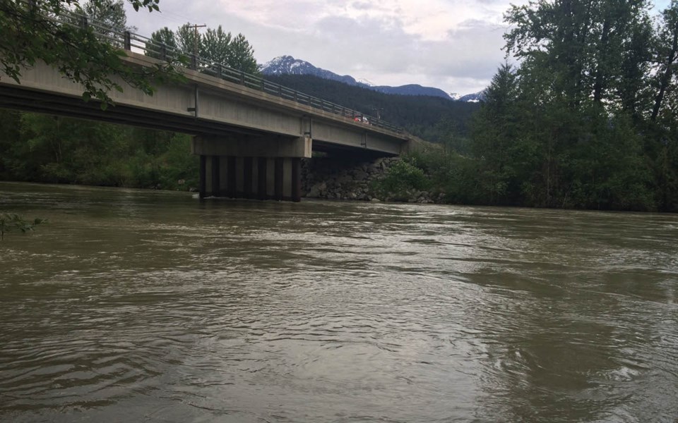
Residents of Pemberton Valley are well aware of the fact that they live on a floodplain. But a new report, commissioned by the Pemberton Valley Dyking District (PVDD) and funded by the province, will likely come as sobering news to some.
The first of its kind in over 20 years, the Lillooet River Floodplain Mapping Report, found that peak discharge flows related to specific flood events are higher than previously understood and infrastructure does not offer as much protection as was previously thought.
"The report tells us the risk that we understood is actually a little bit higher (than we thought), and as a community, we're going to have to be more aware of the flood threat," explained Ryan Wainwright, emergency program manager with the Squamish-Lillooet Regional District (SLRD).
The report explained that the 2010 Mount Meager landslide has exacerbated flood risk in the Pemberton Valley. It took place around 66 kilometres upstream of Pemberton and caused some channel blockage of Meager Creek and the Lillooet River, but no major flood.
According to the report, the landslide deposited millions of cubic metres of sediment into the river system.
"That gravel got all built up, and some of it moved downstream ... but a lot of it is slowly moving down the system," explained Wainwright.
"It will take 20 or 30 years for (the sediment) to get pushed out into Lillooet Lake, and as it moves through the system, it will effectively raise the bottom of the river."
The report also pointed to the effects of climate change on flood risk—floods are now more likely to occur in the fall (following rain-on-snow events) than in the spring.
The report should also be viewed as a call to action for Pemberton Valley residents.
"The more responsibility that people take on for personal preparedness, the more that frees people like me and the RCMP and other response agencies up to help those who are in desperate need," said Wainright.
Steve Flynn, operations and maintenance manager at the Pemberton Valley Dyking District (PVDD), said the report is extremely valuable. "Previous to this report coming out, we didn't have a good understanding of the situation, but now we do, and now we are able to act on it," he said.
The last substantial update to floodplain mapping on the Lillooet River was conducted in 1990.
Flynn said the PVDD has been getting the word out to the public about the report's findings and will work with local jurisdictions—the Village of Pemberton (VOP), the SLRD, and Lil'wat Nation—to mitigate risk.
He said there are a number of mitigation strategies available, including upgrading existing infrastructure, or building smaller dykes to protect key zones and infrastructure.
The projects will be identified by the PVDD and prioritized in coordination with local jurisdictions, said Flynn. "Once we've identified and prioritized them, then we will have to develop plans and budgets for the high-priority projects," he said.
"And once we have done that, we can go seek the funding because I'm sure a lot of these projects will be beyond what the tax base in the valley can support."
VOP Mayor Mike Richman said the report contained valuable information, and noted that VOP council has asked staff to review it and determine the best course of action.
Richman also noted that council is supporting a joint application—along with the SLRD and Lil'wat Nation—for a Union of BC Municipalities' grant to pay for an evacuation route plan for the Pemberton Valley.
The planning grant would be for up to $70,000; the goal of the plan would be to identify safe routes out of the valley.
"As you saw in the wildfire season in B.C. (last summer), any number of natural events can happen, and again with climate change they seem to be happening more frequently," said Richman. "It's time to up our game when it comes to emergency preparedness."
Animations on how different flood events are anticipated to occur are available on the SLRD's website: www.slrd.bc.ca/services/emergency-management/local-hazard-warnings/pemberton-valley-flood-hazard.


