
One friend's text said, "I don't know how you do it every year." Another's opined that his "body was sore just thinking about it." What both were referencing was what has become an annual-ish pilgrimage for me — a drive across Canada from Whistler to Ontario/Quebec and back. As I write this Monday afternoon (Oct. 9), this year's incarnation is in the books. I left Montreal on the morning of Oct. 6 and arrived in Whistler an hour ago, four days hence. Considering that I woke up in Ontario yesterday and slept in Calgary last night, you might wonder how I plot the drive... but we'll get to that. First, I'll address my friends' concerns. How I do it is easy: I don't find the drive difficult or onerous; in fact, I love and look forward to it — more so each year.
Summer is my main work season, with many projects stacked on top of each other and reams of daily writing required, so a long drive offers respite for both mind and fingers. I line up podcasts and audio books (some concerned with work or research I might happen to be doing), and spend a good deal of time acquainting myself with the radio-dial position of local CBC affiliates. Time flies when you're listening and learning, with music to fill the gaps. But I also enjoy watching the slow, geographic leitmotif that unfolds outside the window. As many occasions as I've watched this informative documentary, I never tire of linking its waypoints into episodes of a series that, though well-known, can change radically with the weather and time of year. Whether taking my time on the way out, or hauling ass coming back, it always keeps my attention.
Episode 1: Montreal to Sault Ste. Marie (990 km). Getting out of Montreal is a trip unto itself. No matter the route, crumbling bridges, pot-holed highways, and illogical road layouts mean you will always be frustrated by construction of some sort. But once you hit the 417 north to Ottawa, it's clear sailing for two hours. Avoiding rush hour in the nation's capital is key, as it adds an extra hour to the drive. Then it's into the upper Ottawa Valley... Arnprior. Renfrew. Camp Petawawa. Chalk River's nuclear facility. Deep River. The La Vase Portages outside North Bay, a 14-km section of the historic Voyageur canoe route that crosses the height of land between the Mattawa and French Rivers. From here to the reclaimed moonscapes of Sudbury and the drive along Lake Huron's North Channel is the heart of the near north. Espanola. Glimpses of the lake at Thessalon. A picnic pullout near Blind River. And the long straightaway into The Sault where sugar maples flame along the highway.
Episode 2: Sault Ste. Marie to Kenora (1,170 km). Leave the motel strip along Great Northern Way around 6 a.m. The highway heads northwest and the sun rises behind as you hit the Lake Superior shoreline at Batchewana Bay. Pancake Bay Campground fronts a funky trading post with all the souvenir kitsch and smoked whitefish. Heading straight north now: Montreal Harbour, Agawa Bay, Pukaskwa National Park. The Algoma Central Railway route, greatest show on earth for fall colours. Wawa's giant goose. The vast inland sub-arctic dome from Wawa to Marathon, punctuated only by White River and its coldest-place-in-Canada thermometer. Rounding the Lakehead. Terrace Bay. Rainbow Falls Provincial Park. The lakeside pullout at Rossport where you wiggle toes in icy water on glacier-polished pink granite. Nipigon's oddly modern bridge. Ancient, bright-red, iron-infused rocks as you creep past the Sleeping Giant. Lunch at the Thunder Bay bypass. Then some serious driving amidst the monotony of taiga to steel your mind to: T-Bay to Upsala. Upsala to Ignace. Ignace to Dryden. Dryden to Kenora. You gain an hour, so use it in Lake of the Woods Brewery.
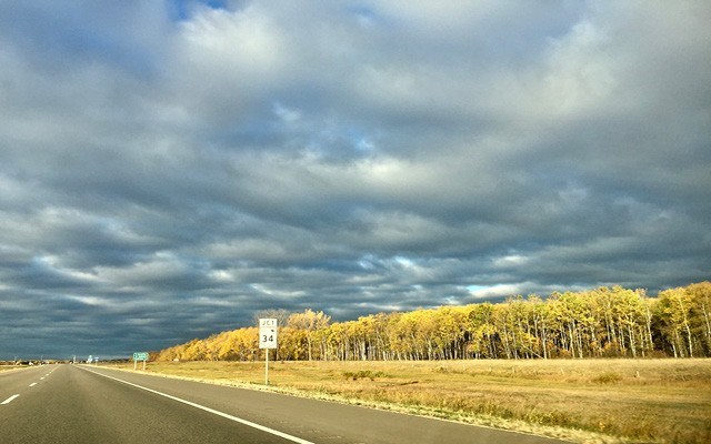
Episode 3: Kenora to Calgary (1,547 km). Leave Kenora at 5 a.m. and be on high-alert for deer for 2.5 hours to Winnipeg. Fly around the bypass. Speed limit is 110 km/hr on the Prairies so you go 120. Portage la Prairie. Brandon. Virden. Saskatchewan border. Moosomin. Regina, its bypass still under construction. Then a parade of the best names on the TransCanada Highway: Moose Jaw, Swift Current, Gull Lake, Maple Creek, Medicine Hat. Finally, the ugliest stretch in the country: Medicine Hat to Calgary, high-voltage wires, decimated grasslands and oil wells, punctuated by the smell of stockyards at Brooks. Stop in Chestermere. You've gained another hour so you should finish this 15-hour drive before sundown, by 7 p.m. at the latest.
Episode 4: Calgary to Whistler (917 km). Leave by 6 a.m. Take the Stoney Creek bypass to avoid Cowtown. Starbucks in Canmore. Sunrise between Banff and Lake Louise. Then B.C., Yoho National Park, Field, Golden. Gain an hour. Join the transport-truck rally over Rogers Pass. Revelstoke. Three Valleys Gap. Sicamous. Salmon Arm. Kamloops. A bathroom break with rattlesnake warnings. Cache Creek. Marble Canyon. Lillooet. Lightfoot Gas whether needed or not. The Duffey Lake Road. Pemberton. Home by 4 p.m., a painless 4,600 km the wiser.
Repeat next year.
Leslie Anthony is a Whistler-based author, editor, biologist and bon vivant who has never met a mountain he didn't like.


