
It can be easy to miss all the little things that go into helping people get around Whistler.
Of course, there's the variety of maps, brochures and signage that point visitors in the right direction, but there's also less obvious wayfinding tools: colour-coded banners demarking a certain area, visual landmarks, as well as pre-visit technologies like a digital app or website.
While the average Whistler visitor may not think twice about wayfinding, it's an issue the RMOW and other community stakeholders have spent countless hours examining with the goal of improving the overall experience for the guest from the moment they set off to Whistler.
"Often people think that wayfinding consists of just coming into town, running around and putting up signs everywhere," explained John Bosio with MERJE Environments and Experiences, which has been contracted by the RMOW to update it's wayfinding strategy at a stakeholder meeting on the topic Oct. 20.
"There's much more to it than just a signage program. It's really about the experience people have when they come to Whistler."
Working with Tourism Whistler (TW) and other key resort stakeholders, the municipality is in the process of finalizing its master wayfinding strategy, which will streamline the flow of information to the 2.4-million annual visitors to the resort to help them get from Point A to Point B, whether it be by foot, car, bike or public transit.
"We commend the RMOW for taking the initiative with this important project," wrote James Buttenshaw, TW's director of planning and partnerships, in an email. "The wayfinding project will help improve the experience for visitors to Whistler, especially first-time visitors, and is going to be positive for the resort and the overall guest experience."
The first step in the process is looking at ways to simplify the existing village map, available at the Whistler Village Visitor Centre and online through Tourism Whistler, by removing some of the visual clutter, and colour-coding different village neighbourhoods.
The current proposal identifies three main areas of the village as Village North, the original village site extending north from Village Gate Boulevard to Lorimer Road; Village Centre, which reaches south to the Whistler Gondola; and the Upper Village near the base of Blackcomb Mountain. At this point, none of the names have been finalized, but the goal is to establish a distinct sense of place for each area, making them more easily identifiable on a map and in person.
"We want to start to build some of those identities and a sense of arrival and departure," said Ted Battiston, the RMOW's manager of special projects.
The same strategy is being used for each of Whistler's five day lots, with designers exploring ways to visually represent each lot and link them to specific landmarks, or activities, so that visitors can find their way back to their car with ease. Each lot could be linked to a specific colour, which will be demarked with banners, as well as a pictograph that represents the area of the village they're parked closest to. The proposed Day Lot 4 logo, for example, features a picture of the Olympic Rings, while the Day Lot 1 is coded with an image of Whistler and Blackcomb Mountains.
The municipality is also looking to create a uniform, resort-wide approach to how wayfinding information is spread, outlining what Bosio called "the hierarchy of information," or the sequence of information users receive along their journey.
The plan is to implement the strategy among all platforms, be it through third-party maps, the Visitors Centre or hotel staff.
"Once this system goes in we can make sure people can use the same information and are explaining things in the same way," Bosio said.
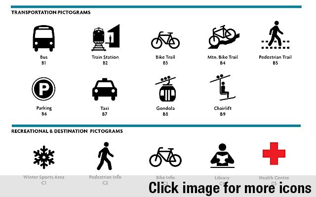
This includes creating a list of preferred pictograms to use on Whistler's network of signs, which Bosio said currently suffers from a lack of consistency.
"The reality is you have all these signs out there ... and they don't talk to each other from a seamless journey standpoint," he said.
While Whistler may see some of the project's minor initiatives, like an updated village map, come into place for this winter season, the expectation is that the wayfinding strategy won't be fully implemented for a few years.
Visit www.whistler.ca/category/tags/wayfinding for more information.


