
B.C. smashed a whopping 34 temperature records as an Arctic outflow dropped temperatures several degrees below the seasonal average.
Records were broken across the province in the following locations: Agassiz; Bella Bella; Bella Coola; Burns Lake; Clearwater; Clinton; Comox; Dawson Creek; Fort Nelson; Fort St. John; Hope; Kamloops; Lillooet; Lytton; Mackenzie; Malahat; Nakusp; Penticton; Port Alberni; Port Hardy; Prince George; Prince Rupert; Puntzi Mountain; Quesnel; Salmon Arm; Sandspit; Sechelt; Smithers; Summerland; Tatlayoko Lake; Terrace; Victoria Harbour; and Williams Lake.
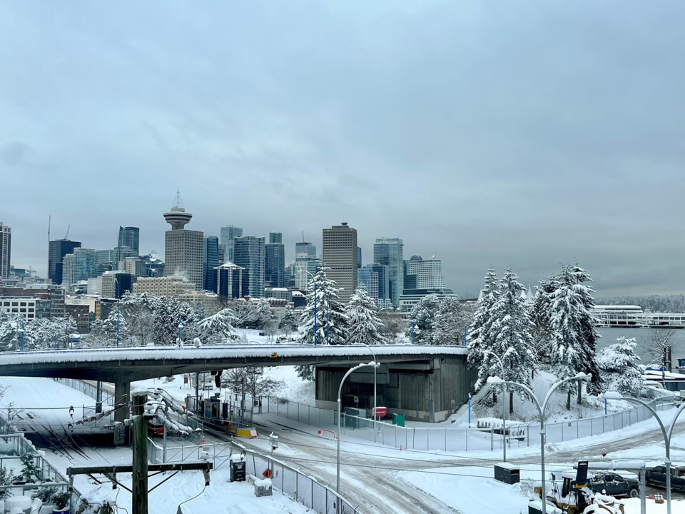
A new temperature record of -12.9 C was also set at the Vancouver International Airport (YVR) on Wednesday (Dec. 21). The previous record of -11.8 C was set in 1990 and records have been kept since 1896.
Environment Canada's Arctic outflow warning is still in place for Metro Vancouver, with windchill values of -20 C to -25 C expected Thursday.
A winter storm watch is also in place for the Lower Mainland, as hazardous conditions are expected for travellers heading into the holiday weekend.
"Travel conditions will be challenging due to heavy snow, ice pellets, freezing rain, and heavy rain on snow or ice," states the warning.
Snowfall amounts of 10 cm to 20 cm are expected overnight Thursday and heading into Friday. On Friday evening, heavy snow will mix with ice pellets and change to rain.
Strong easterly winds could produce "near zero" visibility with blowing snow. Freezing rain could also make road conditions treacherous.
Take extra care when walking or driving in affected areas. Ice build-up may cause tree branches to break.
Metro Vancouver weather over the past week
Metro Vancouverites woke up to several feet of snowfall Tuesday morning following the biggest winter storm of the year.
Downtown Vancouver received 30 cm of snowfall overnight, while other areas, such as Tsawwassen and South Surrey, received as much as 35 cm, according to Environment Canada's weather summaries.
Locals took to social media early Tuesday morning to share images of the fresh snowfall, showcasing accumulation amounts across the city and the greater Vancouver area.


