
A long-awaited pedestrian bridge over Pemberton Creek in the village’s Tiayata neighbourhood is one step closer to being finalized.
The Village of Pemberton’s (VOP) manager of developmental services Scott McRae was on hand at the July 12 Committee of the Whole (COW) meeting to update mayor and council on the next steps staff will be taking towards completion of the project.
Plans for the bridge were first included as part of the community amenity contributions in the original draft for the Tiyata Village development. The obligation was passed on to School District 93 when it acquired a portion of the land for the future École La Vallée (along with several other obligations to be completed prior to the school being developed).
In October 2021, council refined the wording around the bridge obligation to remove the full burden from the school district, passing a motion stating SD93 will “continue to collaborate with staff, adjacent landowners, and the Province to deliver a public pedestrian Pemberton Creek crossing.”
According to McRae, a land study was done by ISL Engineering to look at potential costs of the project and the best possible locations for the bridge using hydraulic modelling and LiDAR.
The study, which was paid for entirely using contributions from Tiyata’s developer, also “took into account design criteria provided by the [VOP] for things like what the bridge deck width would be roughly, what kind of equipment we wanted to drive over it—like a bobcat with snowblower attachment—and what kind of users we expected the trail to see,” before settling on three options, said McRae.
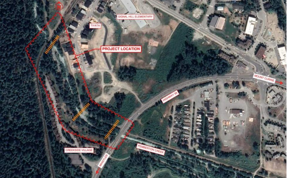
“Option A is just upstream of the Highway 99 bridge over Pemberton Creek. Option B is kind of midway between the highway bridge and the rail bridge, it’s kind of a natural narrow point in the channel. And then Option C is just downstream of the rail bridge.”
While McRae’s report was strictly for update purposes and wasn’t seeking any decisions at this time, mayor and council still got their first up-close look at the three proposed locations for the bridge, as well as the advantages, challenges and potential costs of each option.
According to the report, Option A has the easiest access for construction, the lowest capital cost and could draw pedestrians away from the often-busy highway bridge. However, it is unknown how any future highway bridge construction could impact the pedestrian bridge.
Option B has the best alignment for the adjacent trails, but requires a bit more earthwork on the southern bank of the creek to make a nice approach. It is also the most costly option, being projected at just over $1 million, approximately $20,000 more than Option A and $10,000 more than Option C.
Finally, located close to the rail bridge, the creek channel is best defined at Option C and may have added protection from excessively high flows by the nearby CN rail bridge.
However, the trail connections on the east side of the creek are unclear, and users may still be inclined to cross the railway bridge unsafely, according to the report.
While McRae noted the Pemberton Valley Diking District prefers Option C due to an often-used creek access near the site of Option B, mayor and council agreed that Option B made the most sense from an accessibility standpoint.
Although it was the preferred option, Mayor Mike Richman did raise concerns about the costs of the project, and wondered if the bridge is being “over-engineered” and being made bigger than necessary.
While VOP staff have negotiated a contribution from SD93 that will “help make the project a reality,” according to a staff report, “significant additional funds” will be needed to finish it.
“Firstly, I would like to echo that every time I do one of these exercises, I get surprised about how much things cost,” said ISL Engineering structural manager Robin Zirnhelt.
“What we have been seeing, though, is tender estimates increasing significantly due to both labour and more importantly materials … So those numbers are reasonable. And my professional judgment is that I wouldn’t reduce the budget at this point given the level of detail that our design has evolved to. But we think it is on the safe side.”
There was also discussion about the width, Zirnhelt said, noting 2.5 metres is the minimum you’d need to get a snow-clearing machine through, as well as the minimum width for multimodal two-way traffic.
“In a backcountry trail, we might pick something like 1.2 metres … but I think the two and a half metres is sort of a minimum,” he said.
Moving forward, McRae and his team will continue working through the planning process with the knowledge that Option B was mayor and council’s first choice.


