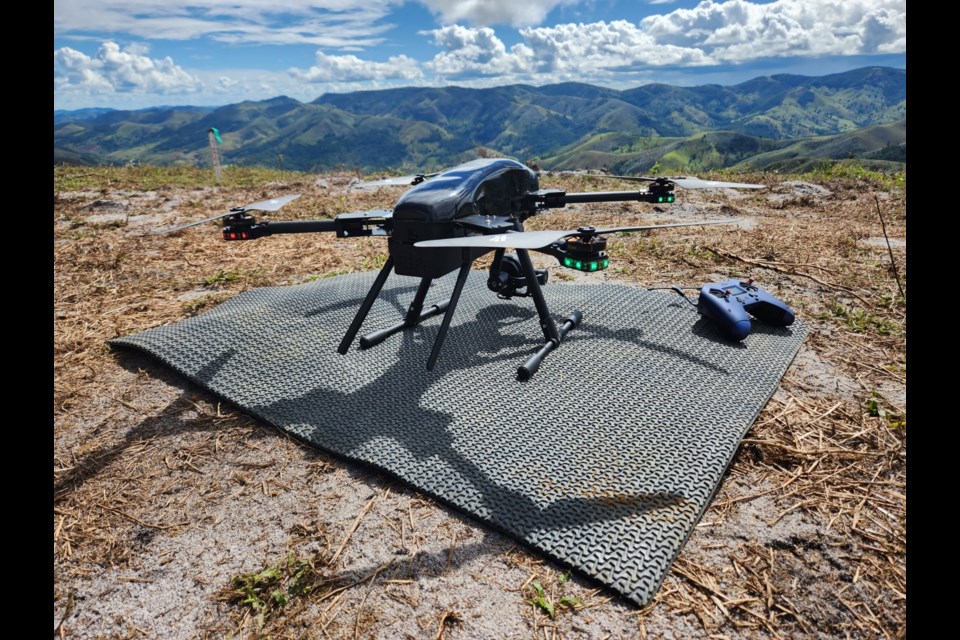
Eric Saczuk remembers the first time he operated a Remotely Piloted Aircraft System (RPAS), known better to most as a drone.
It was sometime around 2015, as the British Columbia Institute of Technology (BCIT) geomatics instructor recalled, when two of his students went out, purchased a drone and brought it to the field at BCIT. They invited Saczuk to try his hand behind the controller. He was hooked.
Now, Saczuk is lead of the Vancouver school’s RPAS Hub, a research chair and geomatics consultant, a photographer, and a Transport Canada certified RPAS flight reviewer. He has used drones to study climate change in Antarctica and Norway, and works with InDro Robotics, a B.C.-based engineering and operations company focused on drone and robotics innovations, including data collection.
More recently, he’s been focused on sharing the knowledge he’s gained with prospective drone pilots. Twenty Whistler-based students will have the opportunity to learn from Saczuk when he brings BCIT’s four-week “Drone Applications for an Environmental Risk Assessment” micro-credential to the Sea to Sky in May.
A grant from the Ministry of Post-Secondary Education and Future Skills, through a program called Canadian Colleges for a Resilient Recovery, means tuition costs are waived for all 20 students. Those funds will also equip each student with a drone they’ll get to keep once the course wraps up. (Students will, however, need to have access to a laptop they can use to process data with.)
“The impetus for [this course] was that BCIT pivoted from what we used to call its part-time studies program into something called flexible learning,” Saczuk explained. “And, in order to build out our capacity in that direction, we’re encouraged to develop micro-credentials, which are these small, intense, very focused learning nuggets for students to give them access to skills that they wouldn’t normally have, or to upgrade education. I really jumped on this opportunity because I thought it’d be perfect to bring the world of RPAS into the hands of interested students.”
Participants will graduate from the course with a Transport Canada RPAS certification, after learning about the regulations governing safe and legal drone operation. Throughout the course, students will also learn how to conduct a site survey and plan a mission, and how to process colour, multi-spectral, and thermal drone images into valuable data sets.
That kind of data can be used for a wide variety of purposes, several of which might come in handy in Whistler: Wildlife tracking, invasive species mapping, and measuring forest health, for example, as well as measuring volcanic gas concentrations or greenhouse gas emissions; deploying thermal sensors to help search-and-rescue crews find lost hikers; delivering first aid supplies beyond road blockages in emergencies; or even for measuring data like elevation, typography or land mass as part of a construction project.
Saczuk recently wrapped up a similar offering on Salt Spring Island, where the youngest student in the course was 17, he said, while the oldest was in their 70s. Saczuk said past participants included engineers, real estate agents, biologists and foresters, to name just a few.
“When we ran the program the first time, in Port Alberni, one of the First Nations students got so lit up about this, he went out and filed for a grant which paid for half the cost of all the equipment he purchased—he really geared up, he went full-tilt with it,” said Saczuk. “He started doing all of this mapping work for members of his community… He’s actually running his own business now where he’s doing drone mapping.”
Saczuk added, “This is the best justification I could think of for continuing to run these courses, is that we go out and enable people to essentially make a living and be passionate about what they do.”
The Whistler course starts May 1, with recorded online sessions from 8:30 to 10 a.m. on Mondays, Wednesdays and Fridays, and in-person learning on Saturdays, typically from 9:30 a.m. to 12:30 p.m. “Typically we start in a classroom, and if everything works out well, we go out into the field and do some flying, do some data collection,” Saczuk explained.
It works out to about seven-and-a-half hours of instruction per week, plus weekly assignments.
Throughout the four weeks, students will attend class online, before heading out to conduct field assignments. As of Friday, March 31, there were four spots remaining in the course.
If you missed your shot to register, you still have a chance to enrol this year: following the Whistler course, Saczuk plans to lead another month-long micro-credential that will be fully online and open to participants across the country.


