
From destructive wildfires to atmospheric river flooding, British Columbia has been plagued with disasters in recent years.
A total of 619 people died during the 2021 heat dome in B.C. This year, B.C.'s most destructive wildfire season on record claimed the lives of six wildland firefighters and destroyed more than 400 properties.
From the growing impact of wildfires and floods to the ever present threat of earthquakes, landslides and tsunamis, escaping environmental catastrophe is becoming increasingly difficult — begging the question, where is the safest place to avoid disaster in British Columbia?
Amid all the risks, could one community be deemed the least hazardous place to live in B.C.?
We gathered 12 experts from across the province to weigh in on what for many was a nearly impossible question to answer.
Many experts did not agree. Others wished us good luck in the effort. Some welcomed the challenge, noting this conversation is happening in their field. Nearly all of them said each location in B.C. has risks and people's lifestyle or cultural limitations influence where people live and what risks they face. A community located at a valley bottom might face low risk from wildfire but a high risk of flooding. Some may face few fires but live in a zone primed for earthquakes.
Expert interviews and an analysis of B.C.'s hazard maps suggests one B.C. community faces lower risks than the rest.
Safest place in B.C.: Burnaby
Most of the experts interviewed for this story agreed that parts of Burnaby are among the safest in B.C.
"Overall, I would say away from areas of liquefaction, away from really soft soil, away from landslide potential, Burnaby fits most of those,” said John Cassidy, a Victoria-based earthquake seismologist with Natural Resources Canada.
"The challenge is that it is very site specific though.”
Cassidy said the areas surrounding Burnaby Mountain and Capitol Hill would likely see less ground shaking due to the underlying bedrock.
The likelihood of a damaging earthquake in the next 50 years in the Lower Mainland is about 20 per cent, explained Cassidy.
“That gives you a ballpark idea,” he said. “That’s our best estimate.”
Most of Burnaby is made up of dense glacier soil. Cassidy explains how a jumble of stone, sand and clay, known as till, was compacted by advancing and receding glaciers during the last ice age. That has left relatively dense deposits. Areas along the rivers and creeks are where the newest and softest soils are.
“When you get close to creeks or rivers or old infilled areas, that's where you have the softest soil and the most likely chance of amplification of shaking,” said the earthquake expert.
Cassidy said longer duration shaking or liquefaction — where shaking forces water up through the soil, sand and stones, instantly turning once solid terrain into a semi-liquid soup — might also play a role.

Heavily urbanized areas like Burnaby tend to face a lower risk from wildfire, especially outside of parks and undeveloped areas, according to Chilliwack-based fire ecologist Robert Gray.
“Areas like the Lower Mainland, even, you know, here in the Fraser Valley, kind of up toward Abbotsford, they're pretty safe,” added Gray.
Armel Castellan, a warning preparedness meteorologist with Environment Canada, said extreme heat is a concern in Burnaby.
“It's still subject to really increasing levels of heat as we go deeper into this decade,” Castellan said.
Brett Gilley, a professor at the University of British Columbia who teaches about natural disasters, agreed Burnaby is a safe choice to minimize risk from environmental hazards.
"I would want to be in places that are wetter in the province, in places that are not directly at sea level, in places that are off the floodplain,” Gilley said. “Large parts of Vancouver and Burnaby are a good example of a region that has less of those concerns. But the individual regions have pockets of concern all throughout them."
Historically, sections of Burnaby have flooded, especially around Still Creek.
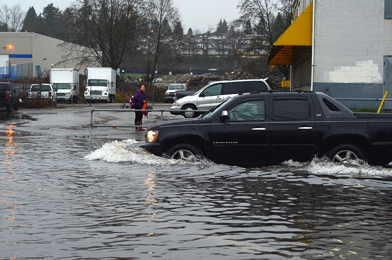
“There are certainly parts of Burnaby that would be flood-free, but there are also parts of Burnaby that are subject to [flooding],” said flood expert Tamsin Lyle.
Lyle pointed to areas adjacent to the Fraser River flooding, Still Creek and Burnaby Lake. She said areas a little higher in Burnaby, such as the Maywood/Metrotown SkyTrain corridor and a ridge running along Hastings Street to Simon Fraser University are safe from a flood perspective.
Living on Burnaby Mountain near Simon Fraser University could pose some serious risks, including landslides, said Joseph Shea, an associate professor of geography at the University of Northern British Columbia.
"There are rain-induced landslides frequently there, and if you combine a major earthquake with saturated soils and steep slopes you could end up with an extremely dangerous situation,” said Shea.
Maps show high-risk liquefaction zones through the middle and south of Burnaby, but no risk on Burnaby Mountain.
When it comes to tsunami risk, the British Columbia tsunami notification zones do not extend into Burnaby. The risk of a Pacific tsunami is very low along the shores surrounding Burnaby because tsunamis lose most of their energy as they crash into shorelines and wrap around headlands.
Overall, flatter, urban areas away from steep slopes and water bodies are the safest locations in Burnaby, according to Glacier Media's analysis.
Earlier this week, we asked readers to vote in our poll. We gave readers seven options based on the top choices from the experts.
Prince George came out on top (25%) as safest choice, followed by Burnaby (20%), Hornby Island (17%), Kamloops (13%), Coquitlam (12%), Vancouver (9%) and Abbotsford (4%).
Each expert interviewed for this story also noted that exposure to natural (or human-driven) disasters are often best understood one hazard at a time. Here are their picks for B.C.'s safest places to avoid catastrophe.
Best places to avoid wildfires
1. Vancouver
2. Abbotsford
A number of fjords along B.C.'s mid-coast have a low risk of wildfire, as well as communities like Tofino and Ucluelet on the west coast of Vancouver Island, said Gray.
“The south Island is fire prone, the east side of Vancouver Island is fire prone,” Gray tells Glacier Media. “Even Haida Gwaii is starting to dry out a bit now. We've seen periods of extended drying there too.”
“We don't think of the coast as being very, you know, flammable or very dangerous from a fire perspective, but we are starting to see changes in climate and weather and that window of probability for fire is just increasing.”
Hillsides in Chilliwack face wildfire risk made worse by dry outflow winds, which sweep down the valley. Up the Sea to Sky corridor, Whistler is also expected to see a higher probability of wildfires in the coming years.
Northern B.C. is drying the fastest in the province, according to Gray, and the Okanagan Valley is currently the most at risk. Human-caused climate change is expected to raise temperatures in the planet's northerly latitudes up to four times faster than the global average.
“We talk about staying below that 1.5 degrees Celsius global mean. Well, the north is already at 2.5 to 3 degrees above that,” he said. “That pattern is just going to increase with the north seeing large fires.”
Best places to avoid floods
1. Burnaby
2. Vancouver
There are not many places in B.C. that are completely free of flood hazards.
"Anywhere you are exposed to water, there is a potential flood risk,” Lyle said. “Pretty much everywhere people live has a flood problem because we like to live near water."
Lyle said there are pockets in the Lower Mainland where hills offer dry refuge and are good choices to avoid flooding.
Areas along the coast are beginning to experience a mix of coastal flooding from big storms, sea level rise and heavy rain events, she said.
Municipalities like Port Moody face an overall higher risk than Burnaby because it has steep creeks and low-lying areas along an extensive coastline. Locations such as Bella Coola are on a floodplain and have steep slopes and gullies above the town.
Coquitlam faces flood hazards from steep creeks and the Fraser River floodplain on its southern boundary.
Drew Brayshaw, a geoscientist and hydrologist in Chilliwack, said there are some real geotechnical issues along the Coquitlam River. He said the areas least likely to flood are places that are high and dry and above floodplains.
“No place is safe, 100 per cent guaranteed from everything,” he said. “So when choosing places we have to balance trade-offs for different hazards.”
His choice to avoid flooding would be Passage Island and the Gulf Islands, as they are away from major watersheds, lakes and smaller streams.
He agrees with Lyle that low-lying areas on floodplains, areas next to lakes or communities built on the waterfront are quite exposed to flood risks.
“It’s hard to find a place that doesn’t have some kind of flood risk, whether it’s direct or indirect,” Lyle said.
Best places to avoid earthquakes
1. Prince George
2. Kamloops
Cassidy said the centre of the province sees the fewest earthquakes, and when they do hit, they tend to be the smallest.
“Along the West Coast, just offshore of Haida Gwaii, that's where these giant plates are moving at about the same speed that your fingernails grow,” he said.
About three-quarters of Canada's earthquakes occur offshore along the West Coast. Major subduction earthquakes — where one tectonic plate violently slips under another — are thought to have historically produced tremors above magnitude nine. Areas such as Haida Gwaii, Victoria and the west coast of Vancouver Island tend to experience more earthquakes.
“Victoria and Vancouver Island is moving at about a centimetre per year towards the Lower Mainland, so it's significant movement,” Cassidy explains.
As you move inland, away from that tectonic plate boundary, the pressure building beneath your feet decreases pretty quickly.
Areas in the Okanagan Valley and up into the Cariboo experience fewer earthquakes. Closer to the Rocky Mountains, there are old tectonic faults — fractures in the rocks of Earth's crust — that can sometimes cause earthquakes.
“We are just not seeing the forces at work in the Interior and most of the stress accumulation is on the West Coast,” said Cassidy.
Big coastal earthquakes, like the magnitude-7.1 event that struck Vancouver Island in 1918, could be felt in the Interior, but the impacts won’t be as catastrophic.
Cassidy said it's important to remember there are always secondary effects from earthquakes.
“Some earthquakes will cause tsunamis or cause a landslide into a lake that can cause very significant waves in lakes. So the Interior, it's hilly, but it's not quite the same as some of the coastal mountains or the fjords, so I think the landslide hazards may be lower,” he said.
He noted the liquefaction effects, where you have water-saturated soils, may not be quite as dramatic in the Interior.
"I think a number of things would be less intense in the Interior of the province,” he said.
When it comes to the Lower Mainland, sections of Coquitlam, Burnaby, Vancouver and North Vancouver have areas built on bedrock less prone to severe shaking.
Best places to avoid landslides
1. Coquitlam
2. Hornby Island
Brent Ward, a professor at Simon Fraser University and co-director of the Centre for Natural Hazards Studies, did not hesitate when asked where in B.C. is the best place to avoid landslides.
Flatter landscapes built from geologic materials unlikely to slump or flow downhill tend to be safer. Ward said many places in Coquitlam, where sandstone bedrock sits fairly close to a surface of glacier till, faces a reduced risk of landslides.
When looking at Vancouver, he also said there are very few places where there’s enough steep hillslopes to have a landslide.
Cassidy said that if there is an earthquake with very strong shaking, it is best to avoid being by the ocean or a lake because landslides can fall into a lake and trigger a very large wave.
Mountainous areas impacted by earthquakes can trigger landslides.
“You can actually see very strong shaking on the top of bedrock hills, and of course, that can also contribute to [a] landslide," said Cassidy.
Ward adds that there are parts of the North Shore that are good for avoiding landslides because of its bedrock foundation. The area's high density of creeks and gullies, however, could lead to more landslides made up to four times worse by climate change, according to one recent study.
Chilliwack could face flooding-induced landslides. Port Moody has an escarpment which could be prone to debris flows. And Delta and Richmond have thick, loose sediments, experts say.
After Coquitlam, Hornby Island was Ward's second choice to avoid landslides in B.C. He acknowledged the island also faces risks from fire and drought.
Best places to avoid tsunamis
1. Interior
2. ‘High ground’
When it comes to avoiding Pacific tsunamis, Cassidy said the safest option is B.C.'s Interior.
"A close runner-up is ‘high ground,’” he said.
But UNBC's Shea said even landslides can generate tsunamis.
"Not big open ocean tsunamis [like ones in] Port Alberni, but there would be little warning of a landslide-generated event,” said Shea.
When looking at other areas, some other choices are not as risky for Pacific tsunamis.
Shea said tsunami hazard is relatively low in the Vancouver area, especially for the Pacific-wide tsunamis.
The areas most at risk to tsunami — both local and distant — are the coasts of Vancouver Island and Haida Gwaii, as well the mainland coast that separates the two islands. Shea said avoiding coastlines that are really exposed, especially on the west coast of Vancouver Island, is key.
"I suspect that many [people] don’t realize that even on the coast, tsunami impacts are typically at elevations less than 10 to 20 metres,” said Cassidy.
In B.C.'s biggest population centre, downtown Vancouver has fairly dense soil with bedrock not too far beneath the surface, making tsunami hazard there relatively low. Earthquake forces are amplified on water-saturated soils, changing it from a solid to a liquid. Silt clay, sand and gravel, deep loose sand and soft soil are all poor ground conditions for earthquakes. Soft soil will result in bigger waves and stronger amplification.
“Most of the downtown core doesn't have that really soft soil that we see in Richmond and Delta. But there are pockets around False Creek and there are parts around Coal Harbour,” said Cassidy.
Professor David Atkinson, geography chair at the University of Victoria, said he’s less worried about a tsunami coming off the Pacific than one generated by the collapse of the Fraser River delta.
“Then we’ll get a tsunami,” he said. “If part of Delta goes in, that’s a large mass. It’s a rock in the water.”
Considerations from climate change experts
Several of the experts interviewed for this story were quick to point out that climate change, evacuation routes and personal choices can impact the safety of a location.
Atkinson said it is technically possible to stack all the dangers up and see what area stands out.
“You can have an area, a city for example, but it doesn’t all present identically to a hazard,” he said. “The levels of risk vary throughout the city and the vulnerability [changes].”
Colin Goldblatt, an associate professor at the University of Victoria's School of Earth and Ocean Sciences, believes trying to find the safest location in B.C. is the wrong question to ask.
"I think the question we should be asking is, if we know climate change is coming, what do we need to do to adapt the communities in which we live, and to mitigate the effects of climate change?” he said.
He believes all of the communities are going to be impacted by climate change. Interior climates have big temperature ranges of very cold winters and warm summers; on the coast, where those temperature extremes are not as present, there are other risks.
“We need to be looking at how we manage our forests, we need to be looking at managing our river systems,” he said.”It’s not choosing that we won’t live near a particular river but that we need to stop building on the floodplain.”
Glacier Media requested floodplain risk data from the B.C. government but was told the most recent map was from 2011. The provincial government declined to make experts available for this story.
“We can’t recommend any one community over another,” said a spokesperson for the Ministry of Environment. "We are in the business of making every community climate-safe. That’s why we’re investing more than $44 million in more than 70 projects in 63 communities."
Environment Canada's Castellan said the task of finding the safest place is a “great” conversation starter and a few locations can be identified.
“We have to consider that drought and heat are things that are part of our landscape now that are going to occur,” he said.
Haida Gwaii and the north coast stood out to Castellan as two of B.C.'s least vulnerable to natural calamity — largely because they will be exposed to less wildfire and the smoke that comes with it. He quickly added that sea levels are rising, potentially putting at risk anyone living in a coastal floodplain.
“If you're looking for clean air, most of the year, (Haida Gwaii) would be a great place,” he said.
Castellan strongly believes each community can take steps to become more resilient and increase its safety.
"British Columbia has seen some high-impact weather, some severe things occur. And the impacts of flooding, of fires, of poor air quality, and all of those things are projected to continue,” Castellan told Glacier Media.
"We need to consider what we can do to best mitigate those recurring events.”
Paul Edmonds, a private emergency management consultant, spends his time assessing hazards, conducting risk assessments and creating evacuation plans. He said everyone should learn the risks in the community they live in.
"I need to live with the environment around me,” he said. "There are some amazing beautiful places in British Columbia. Some places I want to live and some I wouldn’t.”
When considering the safest place, Edmonds thinks about the evacuation route and has concerns with locations such as Vancouver Island and the Lower Mainland. A catastrophic tsunami or earthquake would severely impact anyone trying to leave Vancouver Island and would cause gridlock in the Lower Mainland, he said.
On the one hand, there is not a single place in B.C. without risk; on the other, Edmonds said a person could live on a property for generations and never face environmental disaster.
“I think people need to do their homework when they’re looking at their property,” he said.
As a reporter in British Columbia since 2017, I have seen firsthand the impacts of Mother Nature. I’ve conducted countless interviews with flood and fire victims and seen the destruction people are left with. From 2017 to 2019, I covered wildfires in the Okanagan and reported on landslides and flooding, including a large landslide that closed Highway 97. I’ve reported on the decimating Lytton fire and interviewed countless First Nation communities who lost rich history after Mother Nature swept through with fires and floods. Days before a large fire came knocking at the community of Logan Lake, I was there speaking with the mayor about their fire smart program. Then in 2021, I questioned ministry staff about why people were stuck on Highway 7 in Hope for hours after a landslide cut off the Lower Mainland from the rest of the province. By trying to answer the question in this article, I hope to create a wider conversation around climate resiliency in the locations we call home.


