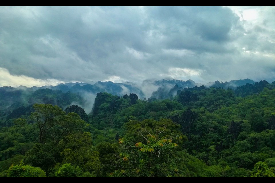
The sleepy border town of Tha Khaek, Laos, is best known for the "Loop," an easy four-day motorcycle circuit. We were here to rent dirt bikes, find tracks less travelled and seek out the historic Ho Chi Minh Trail for the next three weeks.
Riding north along the Mek ong River and east toward Khounkham, my travel companion Astried Huebner and I admired the impressive karst scenery. The famed Konglor Cave, a spectacular 7.5 kilometre river flowing through the mountains, lies 65 kms south and cannot be missed.
In search of jungle trails, hydro workers pointed us to a narrow, deeply rutted track near Thalang—Astried's off-road introduction. After several tumbles, her gears would not engage, leading to a minor meltdown and a moment of self-doubt. I gave her my bike and pushed hers four kilometres up steep ascents, coasting downhill, eventually emerging in the flats and inching into the nearest village to a shop where I repaired the cable.
A barbecue beckoned, the cook proudly grilling maa—dog—a delicacy. One look at Astried told me the answer lay next door at the chicken restaurant and over dinner, she said if the Ho Chi Minh Trail was going to be like that, she was uncertain of her ability to continue. I assured her the worst was over, going to sleep hoping I was correct.
"Let's carry on," she smiled the next morning and we headed toward the Vietnam border. After repairing Astried's first flat tire and with spare tube in hand, we found our first section of the Ho Chi Minh Trail, a network used by the North Vietnamese Army to get around the U.S. Army during the Vietnam war. Eastern Laos was subject to Nixon's covert bombing, evidenced by gardens lined with shell casings.
We wound through the jungle, climbing, descending, circling colossal karst outcroppings and passing occasional villages. The rainy season had scarred the roads with deep ravines, knocked out the bridge at Xe Bangfai River and the current was too powerful to cross. Upstream, a couple with a narrow dugout smiled and beckoned and I knew that if I didn't roll onboard the journey was finished. Without a word, I rolled down the steep embankment, boarded, placed my feet on the gunnels and held my breath. They paddled back for Astried and when she was safely across, she sat down, eyes as big as saucers, saying: "I thought you were going to come back and take my bike."
An incongruous asphalt road appeared like a scene from a movie and we entered the frontier town of Bua La Pha, stopping for pho, a sumptuous soup broth with meat and a plate of vegetables to mix in. The owner, learning our plans, nodded and said "many rivers."
The road ended abruptly at the edge of town, so I asked a woman for directions. I ask women because if they don't know, they say so while men point in random directions to save face. She pointed left and said turn right after the bridge—a loose term referring to planks the width of a tire that you pray won't break.
At a nearby fork a man appeared pointing us straight, a second right and a third said turn back, as if to prove my theory. A fourth said to "follow me" so we chased his dust, crossing rivers of varying widths and depths to Khok village.
Around the bend, a wide river met us and we watched a motorcycle cross the strong current, stalling in thigh deep water, the rider pushing the rest of the way. A crowd gathered and a man pointed upstream where I powered in, stalling half-way, waist deep and pushing across. Astried did the same and I dried the spark plug caps, holding my breath until the bikes fired.
Several junctions followed where GPS, map and Google Maps failed to correlate but we eventually popped out in Villabouly, a mining town marked by stripped hilltops and deforestation, and I wondered what Ho Chi Minh would think of the hunt for resources. We were told that although foreigners were rare, a group had been through recently, as in "six months ago."
Dodging potholes deep enough to swallow a truck we intersected a good road to Muang Phin finding a guesthouse. Accommodation is generally modern, clean, and most have hot water, a welcome refreshment after another dusty day.
National Highway #23 south to Salavan is clear on the map—the GPS disagreed. The rocky trail became potholed and ravine ravaged and across the Xe Pouan River near the village of Tat Hai, it disappeared. Zigging and zagging in soft sand, hard rock and mud we dead reckoned for 65 kms and then, magically, a sealed road appeared for the final miles to Salavan.
Pick up Pique next week, or go online to www.piquenewsmagazine.com, to read Part 2 of Tim's adventure in Laos next week.
Tim Morch is a chronic traveller who dreams of being a writer when he grows up. Whether in the saddle of a bicycle or motorcycle, the cockpit of a sea kayak, riding a wave or trekking a backcountry trail, Tim has a love of adventure and a passion for discovery. You can learn more about him at timmorch.com.


