
Colder-than-usual spring temperatures and an above-average snowpack are prompting flooding concerns in the Pemberton Valley, according to the Pemberton Valley Dyking District (PVDD).
So far, this year has seen half the usual spring melt (or freshet), said the PVDD in a May 18 Facebook post.
“The freshet will not start! Last year on this date, the Lillooet River was flowing at 286 m3/sec, and today it is at 89 m3/sec. The Fraser River at Hope was flowing at over 6,000 m3/sec last year, and today it is at 3,800 m3/sec. This delayed snowmelt, and in our region, the ongoing snowpack development, is a concern,” the post read.
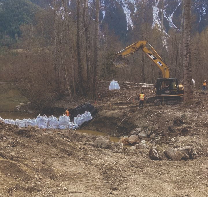
The late melting of the snowpack is worrying due to the potential for higher-than-normal stream flows, which can potentially lead to flooding. The diking district noted that the delayed freshet is similar to 1948, when the Fraser River experienced one of its largest floods in living memory.
“In the last large flood on the Fraser in 1948, the weather mirrored what we are seeing this year very closely,” PVDD’s Facebook post continued. “The only difference is that this year we had a warmer-than-average March, and in 1948 we had a colder-than-average March.”
Overall, 2022 has been abnormally cold so far. Century-old temperature records have been shattered in the region, with the snowpack actually increasing in the Coastal Mountains.
Longer-lasting snowpacks mean the Hurley River Forest Service Road is staying closed longer, the bike season is slower to start and, most worrying of all, this extra snow could melt and melt fast.
“What’s happened this year is we’ve had a continuing build of the late-season snowpack with a colder-than-average April and May. So what that means is that the snow is going to melt at a faster pace than it normally would if we had normal weather in April and May,” said PVDD operations and maintenance manager Kevin Clark.
Clark noted that rapid melting events are tough to predict, and flood events at this point in time are as likely as they are unlikely.
“It’s really hard to tell, because it depends on many things. Alpine temperature and humidity affect snowmelt and overnight temperatures. So you can have a hot day, but if the alpine temperatures in the night dip down, then we’re OK,” he said.
“It’s if we get a heat event like we had last year, where we’re up in the 40s and the evening temperatures in the alpines were in the 20s. That’s what causes us concern, but if Mother Nature cooperates and we get some warm days, and it cools off at night like it should, then we might just have a higher flow rate for most of the summer.”
Typically, the spring melt takes place through May and peaks in mid-June before tapering off through the summer, Clark said.
“So what it means is that the rivers normally run at 350 or 400 cubic metres per second for most of the melt,” he said.
With the delayed freshet, “what it means is we might just be running at 500 or 550 [m3/sec]. But that’s OK. If we get above 750 or 800, that’s when things get complicated.”
Down the highway in Whistler, there have been several historical flooding events since the ’70s, many related to Fitzsimmons Creek or low-lying areas like Tapley’s Farm, said Resort Municipality of Whistler (RMOW) emergency services coordinator Ryan Donohue.
“We’ve done some flood mitigation strategies over the past 10 or so years to help mitigate that, with the diking along the training berm, along the village and the day lots extending through White Gold, Spruce Grove and into the Mons area,” Donohue said.
With the snowpack still remaining in the alpine, a rapid rise in temperatures could lead to “an unusual amount of runoff over a very short period of time coming into the creeks,” he added.
“So that was one of the main concerns about us having such a cold and precipitation-heavy month or spring in May here: additional snowpack on the mountains,” he said. “Obviously, it’s going to melt when it gets hot. It’ll be over a much shorter span of time than it usually is in spring.”
The RMOW monitors River Forecast Centre reports and uses a flood risk grading tool to assess how incoming weather events might impact river levels in the resort.
If the risk is high and flooding imminent, “we would activate our emergency operations centre to support the ground-level flood response,” Donohue said. “At that point, we will probably be starting to communicate [with the public].”
Sea to Sky residents are advised to make sure they have downloaded their local government areas’ respective emergency alert applications and have an emergency kit prepared for worst-case scenarios.
“All the emergency preparedness is done through the Village of Pemberton, the regional district, or Lil’wat First Nation. So if people are wondering what the current situation is, then look to each of those local governments for updates. As the diking district works through them, if we do get a forecast, which puts us on alert, then that’s who puts out the information to the residents,” said Clark.
“It’s good to have people just understand the snowpack for what it is, and they can get ready, or if they are concerned, they can always reach out to the diking district or their local government for any advice that they might need,” said Clark.
If you are interested in learning more about the diking district or want to get involved, the PVDD is holding its annual general meeting, which is open to the public, on July 14 at 7 p.m. at the Pemberton Community Centre.
Find more info at pvdd.ca.


