
Whistler and the Sea to Sky corridor are bracing for the region’s first major snowstorm of the season.
On Tuesday morning, Nov. 29, Environment Canada upgraded the special weather statement it issued Monday to a winter storm warning ahead of the heavy snow and strong winds expected to hit B.C.'s South Coast this afternoon.
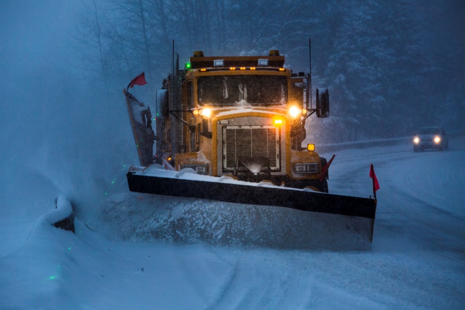
The weather agency says Whistler will see between 25 to 40 centimetres of snowfall by Wednesday morning, with powerful outflow winds expected to add to the hazardous conditions. Gusts could reach speeds of up to 90 kilometres per hour south of Squamish tonight, according to the warning. Winds will ease up by morning.
Environment Canada attributes the incoming storm to a strong low-pressure system that’s currently approaching Vancouver Island. The majority of the snow will fall overnight, though “periods of heavy flurries” are expected to linger throughout the day Wednesday.
“Surfaces such as highways, roads, walkways and parking lots may become difficult to navigate due to accumulating snow,” the storm warning read.
Motorists are advised to prepare for "quickly changing and deteriorating travel conditions,” Environment Canada added. “Visibility will be suddenly reduced to near zero at times in heavy snow and blowing snow.”
Significant snow paired with high winds could cause damage to trees and other structures.
Temperatures in Whistler will remain on the low side Tuesday night, with a high of -7 C that will feel more like -12 C with the wind chill.


