
The New York Times has referred to him as the "Rembrandt of the ski trail," The Washington Post has called him the "Michelangelo of snow," and if you fold open a Whistler Blackcomb trail map, you'll see his name, written amid the forest under the base of the Crystal Chair: James Niehues.
In an astonishing career—which began in 1987 and will soon be catalogued in a coffee table book—Niehues has painted over 200 trail maps. In B.C. alone, the renowned artist has painted maps for Kicking Horse, Red Mountain, Sun Peaks, Revelstoke, Seymour, Silverstar, Panorama and Mount Washington.
Yet according to Niehues, his depiction of an early Whistler Mountain, painted in 1992, was a highlight of his artistic life.
"It was probably my first (map) with spectacular bowls and a neat backdrop," he explained, from his home in Colorado. "It was a very challenging and rewarding mountain to do."
Back in those days, the Whistler Mountain Ski Corporation and Blackcomb Mountain were rivals—and in 1993, Niehues was asked to paint Blackcomb. In 1998, after the mountains were combined by Intrawest, Niehues painted Whistler Blackcomb's (WB) current trail map.
As with all his maps, the image situates the resort against its backdrop, detailing the iconic Spearhead Range and the Overlord Glacier in addition mountain infrastructure and the topography of the challenging resort.
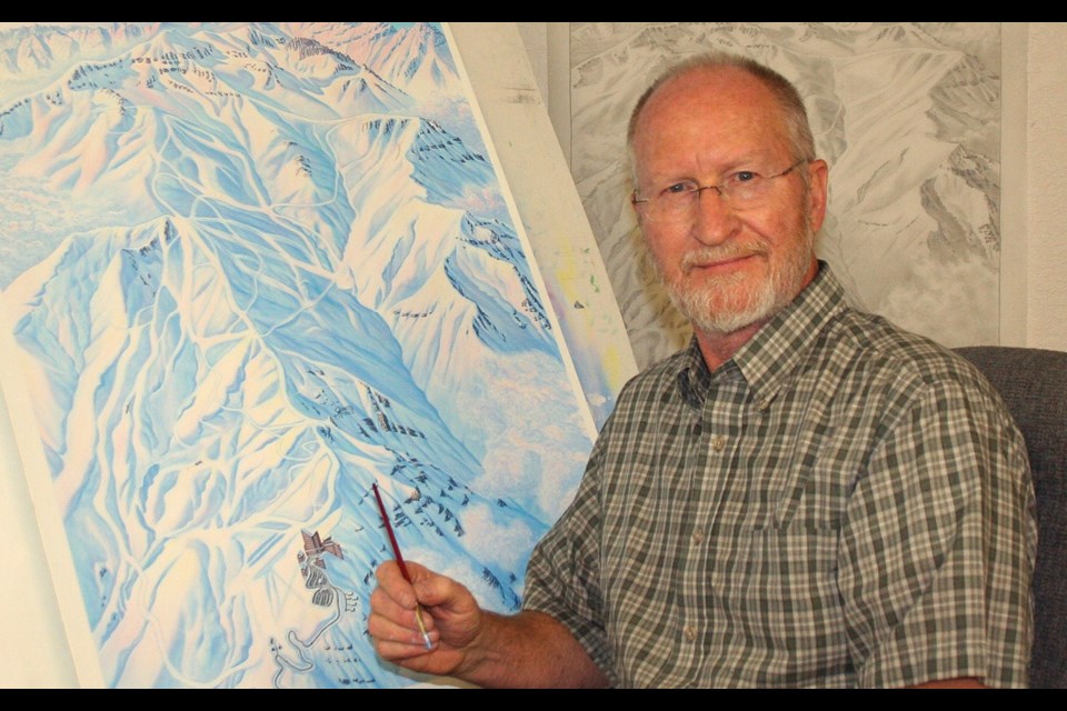
As is his preferred method, Niehues took to the air to study his subject, shooting photos from a plane that flew high above then swooped down for closer views.
"It's important to look down on the mountain instead of across (at the mountain)," he said. "You've got to look down (at) trees and what's gladed and what the runs are doing."Niehues's photos end up serving as the "puzzle pieces" for his maps.
At his studio, he draws upon them, first producing a black-and-white sketch before transferring to an illustration board, where he hand paints his intricate maps using watercolour paint.
Niehues is the first to admit that his maps aren't—at least in the narrow sense of the word—accurate.
"Accuracy is a perception," he said, striking a philosophical note. "And my maps—none of them are accurate in terms of exact distances and so forth ... I'm doing a lot of stretching, squeezing, and manipulating the terrain so that it will all fit together."
Instead, Niehues views his maps as "interpretations" of the landscape that strive to be easily understood by any skier or boarder.
"You can look at my map and instantly know how the mountain lays out," he said.
But while dimensions may be manipulated, the details, such as where cliffs or gullies lie, are all there. "It's very important to have the right tree in the right place—if you have aspens, show the aspens, where there are deciduous trees (show) where they are," he added.
Niehues's forthcoming book will give people an opportunity to see a stripped-down version of his art. The paintings will feature lifts and some useful information, such as elevation levels. But they won't have the names of every run and their ratings, identifying information that is added on by the various resorts he works for.
The work "presents more as art than as trail maps," he said. "This is an opportunity to see how (the maps) were painted, and how I intended them to be printed as far as colour goes."
With over three decades of experience, Niehues is still going strong, a highly sought after artist who is currently working on a new map for Sun Peaks, having recently completed one for Mt. Bachelor. Reflecting on his career, he said he is happy to have found something that combined his love of photography, painting, and flying—and has garnered a wide audience.
"I'm always gratified when skiers come down, grab a beer, open up a map and talk about where they've been," he said.


